

WEATHER OUTLOOK
PAGASA: LPA east of Luzon unlikely to become tropical depression in 24 hours
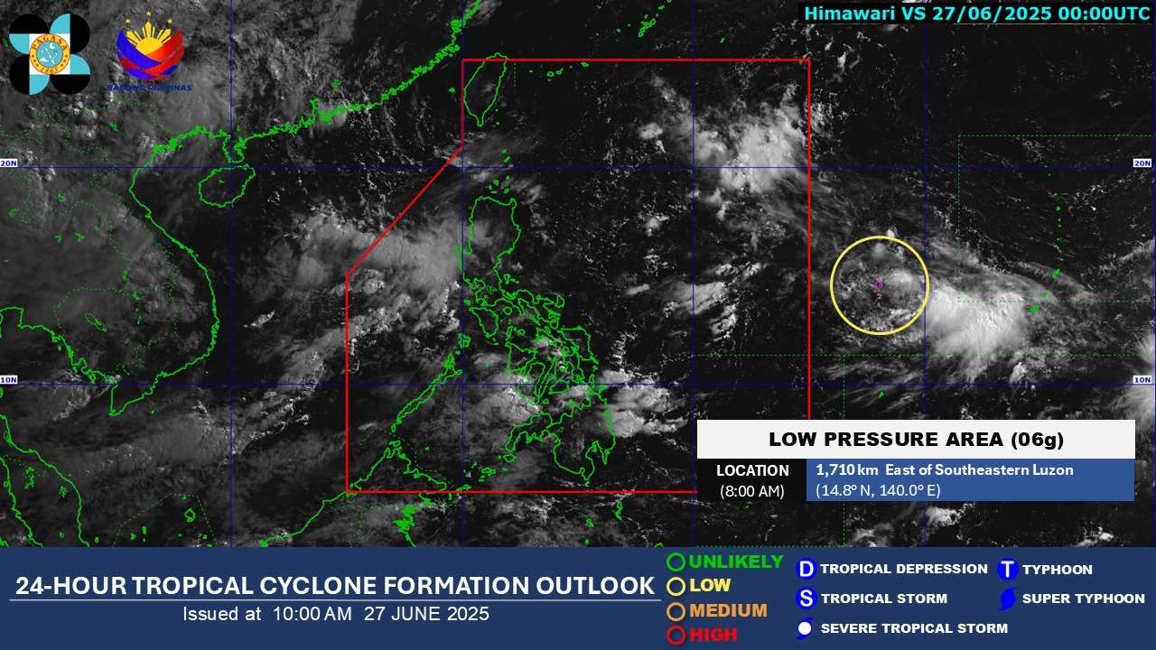
The Philippine Atmospheric, Geophysical and Astronomical Services Administration (PAGASA) reports a Low Pressure Area located approximately 1,710 kilometers east of Southeastern Luzon. As of 8:00 AM today, June 27, 2025, the LPA is positioned at 14.8°N, 140.0°E, outside the Philippine Area of Responsibility (PAR).
According to PAGASA’s latest 24-hour tropical cyclone formation outlook, issued at 10:00 AM on June 27, 2025, the LPA has a “low” chance of developing into a tropical depression within the next 24 hours, making it unlikely to intensify.
Meanwhile, for June 20-21, the Intertropical Convergence Zone (ITCZ) is expected to bring cloudy skies with scattered rains and thunderstorms over Mindanao, Visayas, and Palawan. Metro Manila and the rest of the country will experience partly cloudy to cloudy skies with isolated rainshowers or thunderstorms due to Easterlies.