

WEATHER UPDATE
PAGASA monitors 3 LPAs, one with high potential to intensify
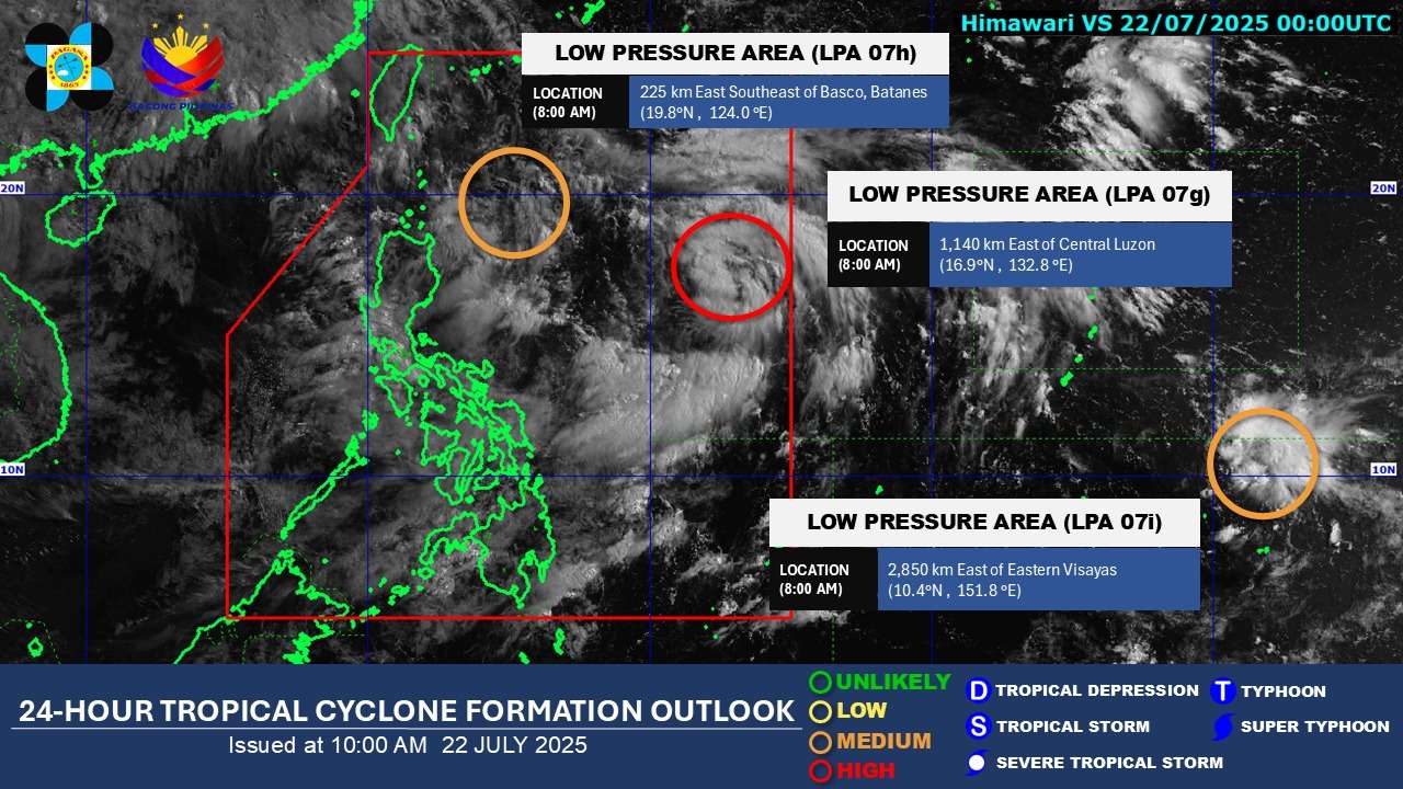
The Philippine Atmospheric, Geophysical and Astronomical Services Administration (PAGASA) is closely monitoring three Low Pressure Areas (LPAs) today, July 22, 2025, as of 8:00 AM, with one showing a “high” potential to develop into a tropical depression within the next 24 hours.
LPA 07g, currently situated within the Philippine Area of Responsibility (PAR), has been flagged with a “HIGH” chance of intensifying into a tropical depression in the coming 24 hours. This development raises concerns for potential adverse weather conditions in affected areas.
Another LPA, designated as LPA 07h, is also being monitored inside PAR and maintains a “MEDIUM” potential for developing into a tropical depression within the same 24-hour timeframe.
Adding to the watchful eye, a third weather disturbance, LPA 07i, is being tracked outside PAR. This LPA also holds a “MEDIUM” potential for developing into a tropical depression within the next 24 hours.
PAGASA emphasizes the importance of continuous monitoring of their advisories for the latest information regarding these weather systems and their potential impact on the country. The presence of these LPAs, along with the ongoing effects of the Southwest Monsoon (Habagat), is expected to bring widespread rains to various parts of Luzon and Visayas.
Residents in areas prone to flooding and landslides are particularly urged to take precautionary measures and prepare for possible inclement weather. Local disaster risk reduction and management offices are advised to be on high alert.