

WEATHER UPDATE
Low pressure area enters PAR, minimal threat of tropical depression in 24 hours
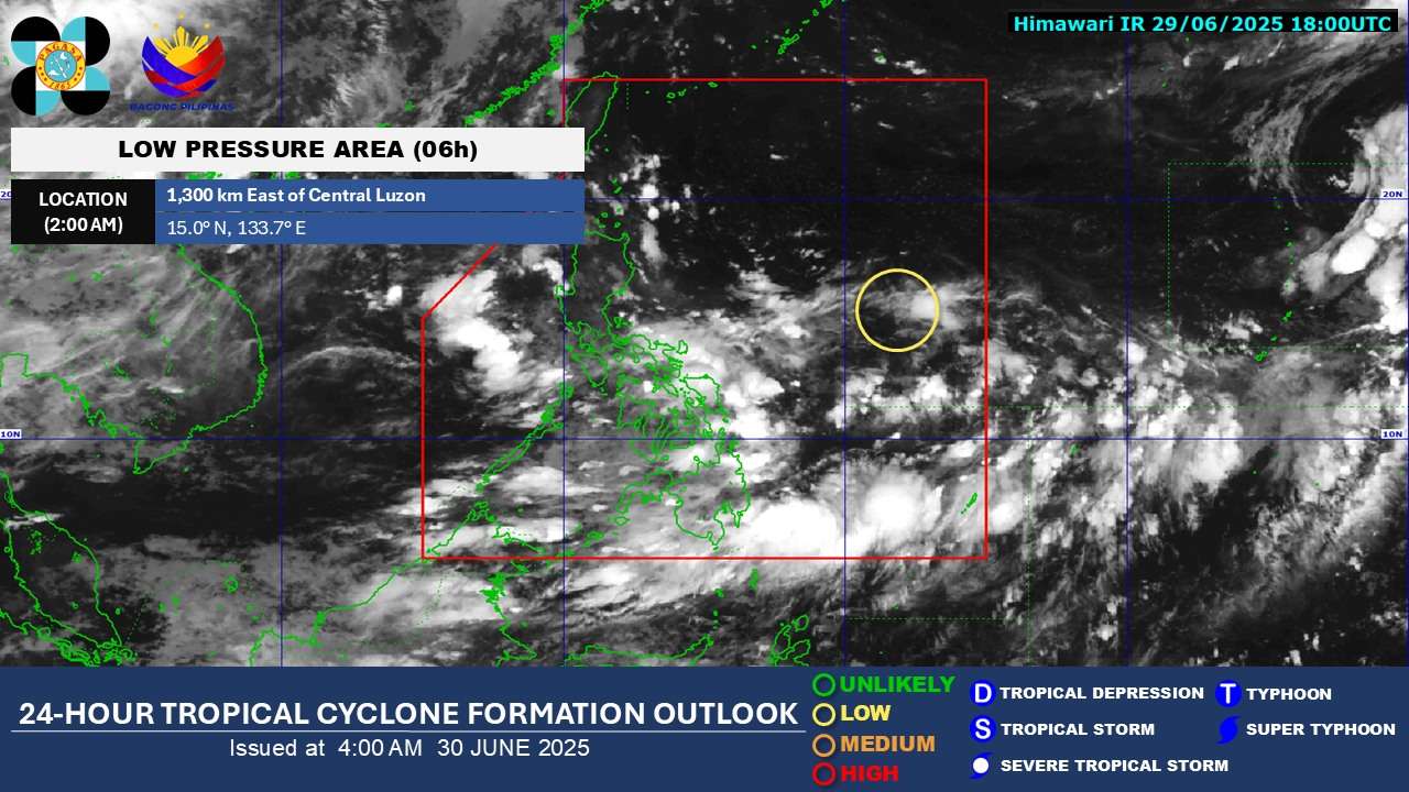
A low pressure area (LPA) previously observed east of the country has now moved into the Philippine Area of Responsibility (PAR) as of Sunday evening, according to the Philippine Atmospheric, Geophysical and Astronomical Services Administration (PAGASA).
As of 3 a.m. on Monday, the weather system was pinpointed approximately 1,230 kilometers east of Central Luzon. PAGASA indicates that the LPA exhibits a “LOW” potential for developing into a tropical depression within the next 24 hours and is not expected to make landfall.
For Monday, the extended reach (trough) of this weather disturbance is anticipated to bring scattered rains and thunderstorms to the regions of Aurora, Quezon, Bicol, and Eastern Visayas. Meanwhile, the southwest monsoon, locally known as Habagat, will influence weather conditions across Metro Manila, the remaining parts of Central and Southern Luzon, Visayas, and Mindanao.
Forecasters predict the LPA will remain in the waters east of Luzon for the coming days, gradually becoming more organized before curving northeastward towards the weekend. Should it strengthen into a tropical storm while still within PAR but moving away from land, it will be assigned the local name “Bising.”
Despite its presence in PAR, the LPA is not foreseen to directly impact the country. However, its presence may intensify the effects of the Habagat, potentially leading to increased rainfall in affected areas.