

WEATHER FORECAST
Twin LPAs inside PAR enhance habagat, bring heavy rains and flood threat to Luzon
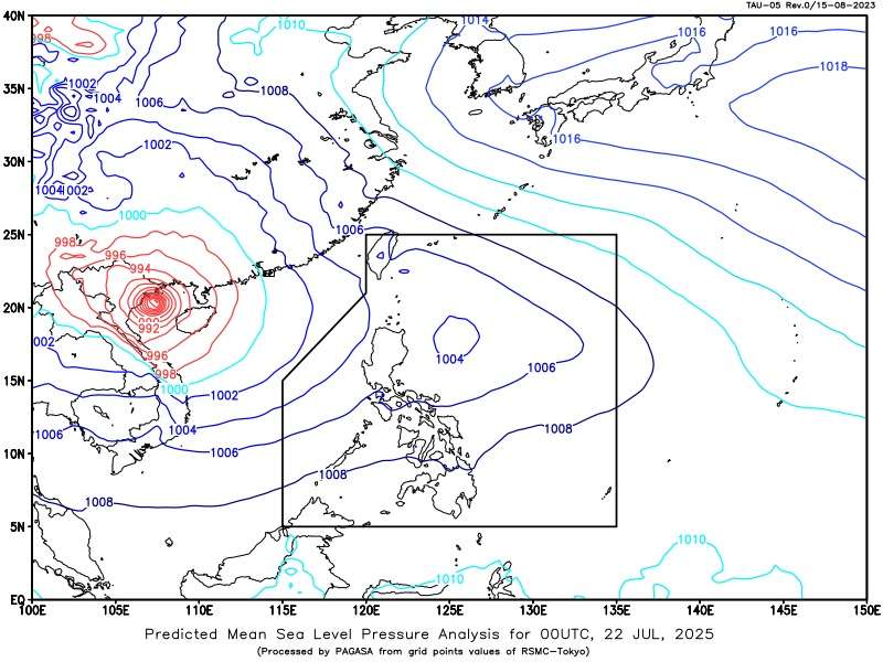
Residents across a significant portion of Luzon, including Metro Manila, are advised to brace for continued “monsoon rains” today as two Low Pressure Areas (LPAs) and the prevailing southwest monsoon combine to bring widespread precipitation. The Philippine Atmospheric, Geophysical and Astronomical Services Administration (PAGASA), in its 4:00 AM weather forecast, warned of possible floods and landslides due to moderate to heavy, with at times intense, rainfall.
As of 3:00 AM today, the first LPA was located approximately 1,140 km East of Central Luzon (16.0°N, 132.8°E). Closer to home, a second LPA was spotted 370 km East of Calayan, Cagayan (19.5°N, 125.0°E). While the southwest monsoon is already affecting the country, the presence of these twin LPAs is expected to further intensify its effects, leading to the observed “monsoon rains.”
Areas specifically identified by PAGASA to be heavily impacted include Metro Manila, CALABARZON, Zambales, Bataan, Pampanga, Bulacan, and Occidental Mindoro. These regions are under alert for the potential of serious flooding in low-lying and urbanized areas, as well as landslides in vulnerable mountainous terrains.
Authorities urge residents in these affected areas to remain vigilant, monitor official weather advisories, and take necessary precautions. Disaster risk reduction and management offices are on standby to respond to any emergencies. The public is advised to prepare for disruptions in daily activities and to avoid unnecessary travel, especially in flood-prone zones.