

#DANTEPH
Tropical Storm Dante slightly intensifies, no wind signals raised
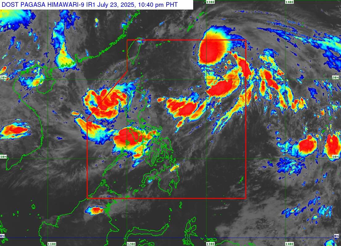
MANILA, Philippines – Tropical Storm “Dante” (international name: Francisco) has slightly intensified as it continues its northwestward movement, according to the latest bulletin from the Philippine Atmospheric, Geophysical and Astronomical Services Administration (PAGASA). As of 11:00 PM on July 23, 2025, no Tropical Cyclone Wind Signals (TCWS) are currently hoisted over any land area in the Philippines, indicating that direct strong winds from the storm are not expected to affect the country at this time.
The center of Tropical Storm DANTE was estimated at 10:00 PM to be 815 km East Northeast of Extreme Northern Luzon, located at 22.4°N, 129.5°E. The storm now possesses maximum sustained winds of 75 km/h near the center and gustiness of up to 90 km/h, with a central pressure of 994 hPa.
Dante is currently moving northwestward at a speed of 15 km/h. Its strong to gale-force winds extend outwards up to 350 km from its center.
While Tropical Storm Dante is not expected to make landfall in the Philippines, PAGASA noted its influence on the enhanced Southwest Monsoon (Habagat). This enhanced monsoon is bringing moderate to torrential rains over various parts of Luzon and Western Visayas, including areas like Pangasinan, Zambales, Bataan, Cavite, Occidental Mindoro, and Metro Manila.
Coastal communities and mariners are advised to exercise caution, particularly in the western seaboards of Luzon, due to the potential for moderate to rough sea conditions caused by the combined effects of Dante and the enhanced Habagat.